When it comes to managing and developing land in Queensland, two key professionals play vital roles in the process:
Town planners and land surveyors.
Their expertise and collaboration are essential in ensuring the proper planning, design, and utilisation of both urban and rural areas. While their responsibilities may overlap to some extent, it’s important to understand the distinct roles each professional plays and how their contributions shape the physical and social landscapes of Queensland.
In this article, we will delve into the differences between town planners and land surveyors, exploring their unique roles and the significance of their collaboration in creating sustainable and thriving communities.
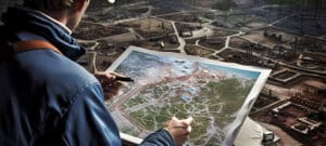
Town Planners: Shaping Communities
They are professionals who specialise in urban and regional planning.
These specialists possess expertise in creating sustainable, functional, and aesthetically pleasing communities. They consider various factors such as social, economic, and environmental impacts to make informed decisions about land use and development. The primary goal is to create vibrant and livable spaces that cater to the needs of residents, businesses, and the environment.
Their role involves:
- Analysing development proposals
- Evaluating the suitability of land for specific purposes
- Ensuring compliance with local regulations and policies
They work closely with government bodies, developers, and community members to create and implement master plans, zoning regulations, and development control policies. They also conduct research and provide expert advice on matters related to urban growth, infrastructure, and public space
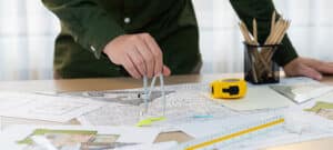
Land Surveyors: Measuring and Mapping
They are involved in the precise measurement, mapping, and delineation of land boundaries.
They play a crucial role in establishing property boundaries, determining land ownership, and providing accurate data required for land-related legal and construction purposes.
In Queensland, they are licensed professionals responsible for conducting surveys, preparing survey plans, and providing cadastral information. They utilise advanced surveying techniques, including GPS technology, to accurately measure and map land features, topography, and legal boundaries. Working in collaboration with town planning experts, architects, engineers, and property owners, they ensure that development plans align with the actual land conditions.
Collaboration and Overlapping Responsibilities
While both have distinct roles, town planners and land surveyors often intersect which requires collaboration and coordination.
Town planning experts rely on the accurate and up-to-date land survey data provided by surveying experts to make informed decisions about land use and development. Surveying experts, in turn, depend on the guidance of town planning experts to ensure that their surveys comply with the established planning policies and regulations.
The collaboration between these specialists is especially critical during the initial stages of land development projects. Town planning experts consult with surveying experts to assess the existing land conditions and conduct feasibility studies. The survey data helps town planning experts identify constraints and opportunities for development, allowing them to design plans that maximise land potential while minimising environmental impact.
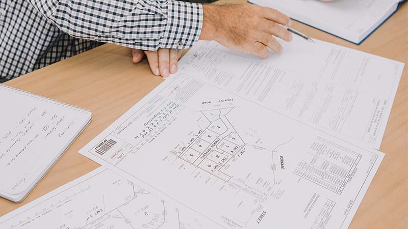
Once the town planners have formulated a development proposal, land surveyors come into play to verify and map the proposed boundaries. They use their expertise to accurately measure and mark the boundaries of the land, ensuring that the proposed development aligns with the legal and physical parameters of the site.
During the construction phase, land surveyors continue to play a crucial role. They provide precise measurements and stake out the boundaries and contours of the land, enabling builders and contractors to construct structures in accordance with the approved plans. Surveyors also conduct as-built surveys to verify that the constructed features align with the approved designs.
Difference between surveying and planning: The Final Word
These roles are complementary and essential for successful land development.
Town planners bring their expertise in urban and regional planning, focusing on the broader aspects of creating sustainable communities. Land surveyors, on the other hand, provide accurate measurements, mapping services, and expertise in determining land boundaries.
Through collaboration and coordination, they contribute to the creation of well-designed, functional, and environmentally conscious communities. Their work ensures that land development projects align with the vision of a sustainable Queensland, balancing the needs of residents, businesses, and the environment.
So, whether you’re a developer, property owner, or government official, recognising the importance of both in the land development process is crucial. By harnessing the expertise of these professionals and fostering collaboration between them, we can build a future where communities in Queensland thrive, with careful consideration for both the present and the generations to come.
Work With Brisbane’s Best Town Planning & Surveying Services at BPlanned
Our team, headed up by Jim Goodwin, has the experience to work with anything from larger subdivisions, infrastructure projects, and private development, both urban and rural.
We’re registered with the Queensland Surveyors Board with a Cadastral and Consulting endorsement. We also have full accreditation with the Department of Natural Resources and Mines to examine and endorse survey plans.
BPlanned is also unique in that it staffs both town planners and surveyors who can work together on the same team to help ensure that sensitive deadlines are met throughout your build process. We understand that specific documents are due at different intervals throughout local council review and approvals, and we coordinate internally to ensure that your milestones are met.
If you’re in need of a survey of any kind (for example, boundary, Form 12) for your build or real estate project, call us on 1300 275 266. You can also request a quote online and we’ll get back to you as promptly as possible.